Up the River Fal - Falmouth Harbour

One of the largest natural harbours, from Falmouth and St Mawes at the southern end to Restroget, Malpas and Truro...
 

One of the largest natural harbours, from Falmouth and St Mawes at the southern end to Restronguet, Malpas and Truro...

Falmouth, one of the largest natural harbours in the world has played an important role in history due to its size and location. King Henry VIII realising its vulnerability to attack, commissioned the building of Pendennis Castle together with St Mawes Castle in 1540 to defend the Carrick Roads.

Falmouth was designated a Royal Mail packet station in 1688 with the purpose to carry mail to and from Britain’s growing empire, and for over 150 years Falmouth Packet ships filled the harbour. It was here that news of Britain’s Victory at Trafalgar & Nelson’s death was first received from HMS Pickle and was despatched to London in a record time of just 38 hours, instead of the usual week.

Because of its size, the harbour is administered by two authorities; Falmouth Penryn, St Mawes and St Just are under Falmouth Harbour Commissioners and North of this the Port of Truro takes control. We will split the Fal pilotage into two sections starting off at the southern end around Falmouth and St Mawes and continuing in part two with pilotage up to Restronguet, Malpas and Truro. Visitors have a choice of moorings from buoys and anchorages in quiet creeks to marinas in bustling towns.

Black Rock marks the entrance to Falmouth and its wealth of harbours. The Carrick Road is the main body of water within the harbour and is the convergence of a handful of rivers running out to sea.

Saint Mawes Harbour

Once past Black Rock, heading North East takes you to Saint Mawes Harbour, a picturesque waterside village. The distinctive St Mawes Castle marks the Northern shore line and once passed the South Cardinal marking Lugo Rock, continue North East towards the small inner drying harbour in front of the village of Saint Mawes.

Chart point 1: Ferry passing in front of the historic Saint Mawes Castle

Visitor Mooring buoys are found to the South East of the Harbour. Anchoring is prohibited within the inner harbour limits and further upstream near Oyster beds. The inner harbour is used primarily by commercial traffic; a frequent ferry service operates all year between St Mawes and Falmouth. St Mawes provides good shelter in weather except from winds with West in them.

Chart point 2: Saint Mawes Inner Harbour

Visitor buoys with Saint Mawes Inner Harbour in the background

Saint Just Creek

Back in the Carrick Road and North of St Mawes on the Eastern shore, the entrance to Saint Just Creek opens to the North of Saint Just Pool and offers a useful anchorage with shelter from the East. To the South of the Pool is a dedicated water ski area from May to September. Saint Just creek has a number of small craft moorings owned by Pascos Boatyard, who have been in operation in the creek since the late 1800s.

Chart point 3: St Just creek with Pascos Boatyard

Penryn River

Passing Black Rock continue North North West and once past the Eastern Breakwater of Falmouth Docks head West into the Penryn River and Falmouth Inner Harbour. Keep clear of large vessels which may be manoeuvering in the docks, such as commercial shipping or super yachts from the Pendennis yard.

The Docks

From 1860 Falmouth Docks developed, due to the rising number of visiting ships. In 1897 the Falmouth Harbour Commissioners and Falmouth Chamber of Commerce paid to have a Time Ball signal on positioned on The Keep at Pendennis Castle. The Time Ball was lowered each day at 1300 hours allowing ships to check their chronometers and ascertain Greenwich Time. The Coastguard station at the castle closed in 1909 and with it went the service.

Falmouth - Pendennis

The choice of mooring from here on up to Penryn is plentiful, the first marina option is Port Pendennis Marina, visitors berths are available on the outer harbour and occasionally in the inner harbour which has a 3m depth and is accessible 3 hours either side of HW via a sill. The National Maritime Museum is located next to the marina, with its lookout tower overlooking the harbour and boats moored below.

Chart point 4: Port Pendennis Marina with the lookout tower of the National Maritime Museum behind.

Entry to Port Pendennis Marina inner harbour is restricted to 3 hours either side of HW due to a sill.

Falmouth – Yacht Haven

Half a mile further upstream Falmouth Harbour Commission operates the Visitors Yacht Haven marina and nearby visitors mooring buoys and anchorage. Toilets/showers and laundry facilities are available near to the entrance of the Yacht Haven A fuel barge serving both diesel and petrol is located on the southern side.

Chart point 5: Visitors Yacht Haven

Chart point 6: Harbour commissioners visitor mooring buoys, Penryn River

Flushing

Continuing North West up the Penryn River leaving the town of Falmouth behind, the small fishing village of Flushing is found to Starboard, built by the Dutch in the 1800’s, and named after their home port. The large houses on the road into the village were once owned by the Captains of the Falmouth Packet boats. A year round ferry service operates between Falmouth and the Quay at Flushing.

Chart point 7: Flushing

Falmouth Marina

Past Flushing the river bends to the West and reveals Falmouth Marina and the outskirts of Penryn. Care should be taken entering the marina; pass close to the outer pontoons leaving the East Cardinal Mark to starboard. This avoids getting stuck on the drying bank which lies to the North of the Marina. The port and starboard channel markers in the vicinity are for continuing up the Penryn River and not for directing you into the marina - if followed they’ll lead you the wrong side of the drying bank for access to the marina

Chart point 8: Falmouth Marina. To enter the marina leave the East Cardinal to Starboard and ignore the Port Lateral mark.

Falmouth Marina fuel berth offering diesel.

Penryn

Penryn at the head of the river was once the main town in the area, the port was used for exporting granite, tin and fish however Penryn lost its custom house and market rights to the new town of Falmouth in the mid-17th Century as a direct result of supporting the Parliamentary side in the English Civil War; as the new town grew, the older port of Penryn declined.

Chart point 9: Penryn

Fact file

Web/Contact
Falmouth Harbour Commissioners www.falmouthport.co.uk
Port Pendennis Marina
www.portpendennis.com
Visitors Yacht Haven
www.falmouthport.co.uk
/yachthaven

Falmouth Marina
www.premiermarinas.com
/falmouth_marina

St Mawes Harbour
www.stmawesharbour.co.uk
Freshwater Boatyard (St Mawes)
www.freshwaterboatyard.com
Pascos Boatyard (St Just)
www.pascosboatyard.co.uk


VHF/Phone
Falmouth Harbour Office
01326 312285
Port Pendennis Marina Ch 80 01326 211211
Visitors Yacht Haven Ch 12 or phone 01326 310991
Falmouth Marina Ch 80 or phone 01326 316620
St Mawes Harbour 01326 270553

Tides

Falmouth
Range
Heights
Spring
4.7m MHWS 5.3
MLWS 0.6
Neap 2.3m MHWN 4.2
MLWN 1.9


Anchorages

Between Custom House Quay & Falmouth Docks, charges apply & vessels may need to move at short notice for commercial vessels using the docks.
Avoid anchoring on Oyster beds past St Mawes in the river Percuil
North of Falmouth Bank in the Carrick Roads
North of St Just Pool, to the West of the entrance to St Just

Charts

Imray Y58
Admiralty SC5602

Click chart to enlarge


Thanks

Chart Y58 is reproduced with the kind permission of Imray.www.imray.com

Chart copyright UKHO. www.ukho.gov.uk

Words &pictures By Simon & Vicky Jinks, SeaRegs www.searegs.co.uk
©SeaRegs2012

© Crown Copyright and/or database rights. Reproduced bypermission of the Controller of Her Majesty’s Stationery Office and theUK Hydrographic Office (www.ukho.gov.uk).

This material is not for resale, redistribution or copying.
Not to be used for navigation.

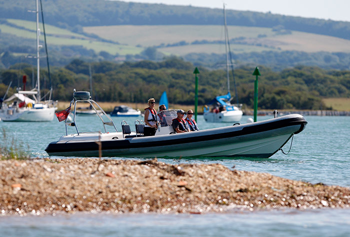
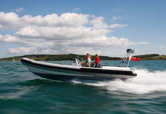
Many thanks to South West Powerboating for the use of their RIB;  southwest-powerboating.co.uk